LiDAR Mapping & Survey
Our pilots are professionally trained to provide the highest quality for your Mapping & Survey projects. When teamed with your civil engineers, we can provide large 2D or 3D orthomosaics that are georectified with your ground survey points or by using the Aeropoints Ground Control Points (GCPs) for quick, inexpensive aerial surveys.
Aerial LiDAR Surveys
Aerial LiDAR Surveys can be far more timely, cost effective and safer than traditional ground surveys, especially in heavily forested and challenging terrains. Although Empire Unmanned is not a licensed surveyor, we routinely partner with Land Developers, Surveying, and Construction firms to collect the aerial LiDAR and High Resolution Photographs for their projects.
We do all the post processing and offer a wide variety of Deliverables for our clients including DEM (Digital Elevation Model) and Contours that allow you to get accurate insight into the ground topography and import into any CAD or GIS Software.
Deliverables: Ground Classified laz file, SHP file with geometry data, DBF attribute file, SHX shape index file, DEM and Accuracy Reports
Classification Options:
1. Ground Only
2. Enhanced Classification – Ground, Buildings, and High Vegetation
3. Enhanced Classification Plus – Ground, Buildings, Vegetation, Roads, Water, Bridges, and Transmission
Add-ons:
1 . Breaklines for enhanced contour accuracy
2. Strip Alignment for increased point cloud accuracy
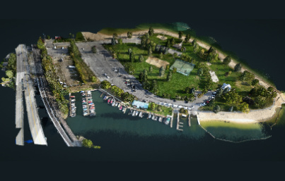
Aerial LiDAR of Sandpoint Beach
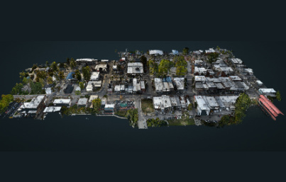
Aerial LiDAR of Downtown Sandpoint, Idaho
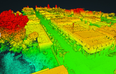
Aerial LiDAR of Downtown Sandpoint, Idaho (Elevation)
Simultaneous Localization & Mapping (SLAM)
Simultaneous Localization and Mapping (SLAM) creates a LiDAR point cloud when collecting in GPS denied environments. This technology is ideal for capturing highly accurate 3D model data inside industrial buildings, urban facilities, tunnels, caves and mine shafts.
This allows map construction of large areas in much shorter spaces of time as areas can be measured using mobile robots, drones or vehicles. SLAM systems simplify data collection and can be used in outdoor or indoor environments.
Deliverables:
1. Visualized Trajectory
2. LAZ of the data captured
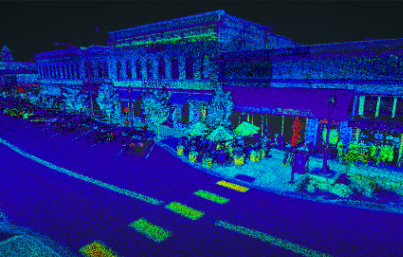
Mobile SLAM of Downtown Sandpoint, Idaho
Planemetrics
Planemetrics combines superior artificial intelligence, machine learning, and quality control to create highly accurate planimetric deliverables. We can tailor your deliverables to specific areas of your dataset so you are paying for only the acreage you need. Planemetrics takes LiDAR data and/or an Orthomosaic and will produce planimetric points, lines, and polygons to digitize the collected data for use in CAD Drawings.
Deliverables:
1. 3D SHP File
2. 3D DWG File
3. 3D DXF File
4. 3D DGN File
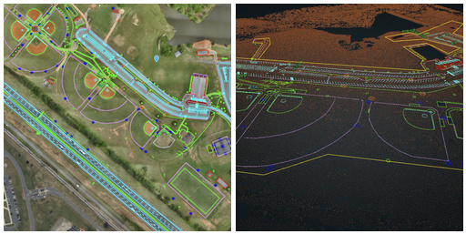
Planemetrics Example
More News About LiDAR Mapping and Surveying
Digital Twins, LiDAR and SLAM – New Technology for the Ancient Science of Urban Planning
If you drive through the old parts of Athens, London, Prague, Rome or Istanbul, you understand some of the limitations of urban planning with a limited toolset. Hippodamus of Miletus, ancient Greek architect, mathematician, philosopher, and meteorologist, is credited...

